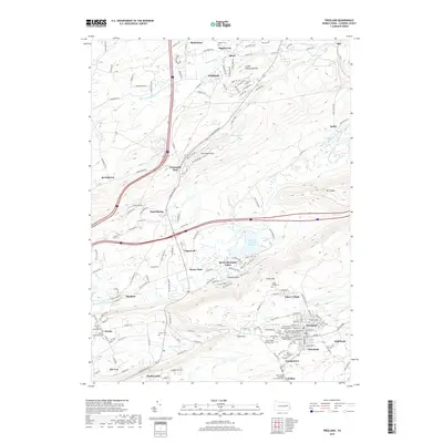
2019 Map of Freeland
USGS Topo · Published 2019About this map
Freeland and its surrounding anthracite-region settlements are the primary focus of this Luzerne County survey. The landscape is defined by the steep ridges of Little Nescopeck Mtn and Buck Mtn, with the town of Freeland itself densely clustered around a grid of streets including Centre St and Front St. Numerous ecclesiastical and burial sites are documented here, such as the Saint John's Roman Catholic Cem and Saints Peter and Paul Cem, which reflect the area's diverse ethnic heritage. To the north and west, the terrain transitions into a series of smaller named locales like Honey Hole, Sand Spring, and Drums. Water features such as Nescopeck Creek and Lake of the Four Seasons wind through the valleys, while the intriguing label Hells Kitchen sits tucked near Green Mtn, hinting at the region's industrial or geographic folklore.
Find a feature on this map
167 named features on this map. Tap any name to fly to it.
Don’t see what you’re looking for? This feature index may not catch every label — zoom into the map to look around manually.
Map Details
Editions of this 2019 Freeland Map
This is the sole edition of this map. No revisions or reprints were ever made.
Other maps of this area

1889 · Hazleton
USGS Topo · 1:62,500

1891 · Wilkesbarre
USGS Topo · 1:62,500

1891 · Hazleton
USGS Topo · 1:62,500

1892 · Mahanoy
USGS Topo · 1:62,500

1893 · Hazleton
USGS Topo · 1:62,500

1893 · Mahanoy
USGS Topo · 1:62,500

1894 · Shickshinny
USGS Topo · 1:62,500

1894 · Wilkesbarre
USGS Topo · 1:62,500

1943 · Scranton
USGS Topo · 1:125,000

1944 · Newark
USGS Topo · 1:250,000
Featured Places
- Freeland, PA
- Dorrance Township, PA
- Nescopeck Pass, Butler Township
- Sand Spring, Butler Township
- Highland, Foster Township