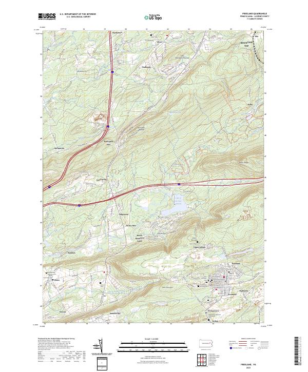
2023 Map of Freeland
USGS Topo · Published 2023About this map
The northern reaches of the Lehigh Valley coal region are documented here, anchored by the borough of Freeland and its surrounding residential enclaves like Highlands and Woodside. The landscape is defined by the steep elevation changes of Nescopeck Mountain and Green Mountain, which historically separated the industrial mining hubs of the south from the agricultural and timbered areas to the north. A significant concentration of religious sites in the southern portion of the map, including Saint John's Roman Catholic Cem and Saint Mary's Byzantine Catholic Cem, reflects the immigrant heritage of the anthracite region.
Find a feature on this map
175 named features on this map. Tap any name to fly to it.
Don’t see what you’re looking for? This feature index may not catch every label — zoom into the map to look around manually.
Map Details
Editions of this 2023 Freeland Map
This is the sole edition of this map. No revisions or reprints were ever made.
Other maps of this area

1889 · Hazleton
USGS Topo · 1:62,500

1891 · Wilkesbarre
USGS Topo · 1:62,500

1891 · Hazleton
USGS Topo · 1:62,500

1892 · Mahanoy
USGS Topo · 1:62,500

1893 · Hazleton
USGS Topo · 1:62,500

1893 · Mahanoy
USGS Topo · 1:62,500

1894 · Shickshinny
USGS Topo · 1:62,500

1894 · Wilkesbarre
USGS Topo · 1:62,500

1943 · Scranton
USGS Topo · 1:125,000

1944 · Newark
USGS Topo · 1:250,000
Featured Places
- Freeland, PA
- Dorrance Township, PA
- Dennison Township, PA
- Nescopeck Pass, Butler Township
- Albert, Wright Township