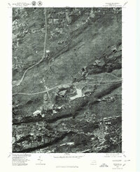
1976 Map of Freeland
USGS Topo · Published 1979About this map
Freeland and its surrounding coal-country settlements are captured here in high-resolution orthophotography from the mid-1970s. The aerial imagery reveals the dense residential patterns of Pardeesville and the smaller clusters of Edgewood and Lindbergh, contrasting sharply with the forested ridges of Nescopeck Mountain and Green Mountain. This specific view provides a rare visual record of land use between the major peaks, where Nescopeck Creek winds through the valley.
Find a feature on this map
8 named features on this map. Tap any name to fly to it.
Don’t see what you’re looking for? This feature index may not catch every label — zoom into the map to look around manually.
Map Details
Editions of this 1976 Freeland Map
This is the sole edition of this map. No revisions or reprints were ever made.
Other maps of this area

1889 · Hazleton
USGS Topo · 1:62,500

1891 · Wilkesbarre
USGS Topo · 1:62,500

1891 · Hazleton
USGS Topo · 1:62,500

1892 · Mahanoy
USGS Topo · 1:62,500

1893 · Hazleton
USGS Topo · 1:62,500

1893 · Mahanoy
USGS Topo · 1:62,500

1894 · Shickshinny
USGS Topo · 1:62,500

1894 · Wilkesbarre
USGS Topo · 1:62,500

1943 · Scranton
USGS Topo · 1:125,000

1944 · Newark
USGS Topo · 1:250,000