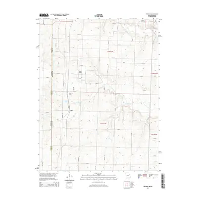
2014 Map of Freeman
USGS Topo · Published 2014About this map
Freeman sits at the northern edge of this West Missouri landscape, a region defined by the winding tributaries of the S Fork S Grand River. The area reflects a classic rural layout of section-line roads, including Cold Water Rd and State Line Rd, which trace the border between Kansas and Missouri. Small rural hubs like Lisle and Bishop's Landing are joined by several small bodies of water, including Cook Lake and Lisle Pond, illustrating a landscape managed for local agriculture and private land use. Genealogists may find interest in the proximity of Freeman Cemetery to the town center, while the presence of the Hilltop Airport suggests the continued importance of regional aviation and local connectivity in Cass County during the early 21st century.
Find a feature on this map
68 named features on this map. Tap any name to fly to it.
Don’t see what you’re looking for? This feature index may not catch every label — zoom into the map to look around manually.
Map Details
Editions of this 2014 Freeman Map
This is the sole edition of this map. No revisions or reprints were ever made.
Other maps of this area

1887 · Harrisonville
USGS Topo · 1:125,000

1887 · Olathe
USGS Topo · 1:125,000

1887 · Butler
USGS Topo · 1:125,000

1887 · Mound City
USGS Topo · 1:125,000

1892 · Harrisonville
USGS Topo · 1:125,000

1893 · Mound City
USGS Topo · 1:125,000

1893 · Olathe
USGS Topo · 1:125,000

1894 · Harrisonville
USGS Topo · 1:125,000

1894 · Butler
USGS Topo · 1:125,000

1947 · Lawrence
USGS Topo · 1:250,000