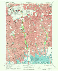
1969 Map of Freeport
USGS Topo · Published 1972About this map
Hempstead and Freeport anchor this mid-century look at the suburban expansion across central Nassau County. The landscape is defined by the dense residential grids of Levittown and East Meadow, punctuated by massive infrastructure projects like the Eisenhower Memorial Park and the sprawling Roosevelt Raceway. This era shows the post-war conversion of land for public and educational use, evidenced by the presence of Hofstra College, Nassau Community College, and the large Meadowbrook Hospital complex. To the south, the map transitions into the intricate tidal geography of Merrick Bay and East Bay, where the shoreline is a maze of inlets and creeks such as Milburn Creek and Bellmore Creek. Transportation networks are at their peak, with the Long Island railroad and major parkways like the Southern State Pkwy and Wantagh State Parkway facilitating the region's rapid growth.
Find a feature on this map
90 named features on this map. Tap any name to fly to it.
Don’t see what you’re looking for? This feature index may not catch every label — zoom into the map to look around manually.
Map Details
Editions of this 1969 Freeport Map
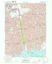
2 editions found
Other maps of this area

1897 · Hempstead
USGS Topo · 1:62,500

1897 · Oyster Bay
USGS Topo · 1:62,500

1898 · Hempstead
USGS Topo · 1:62,500

1898 · Oyster Bay
USGS Topo · 1:62,500

1899 · Hempstead
USGS Topo · 1:62,500

1900 · Oyster Bay
USGS Topo · 1:62,500

1901 · Babylon
USGS Topo · 1:62,500

1901 · Northport
USGS Topo · 1:62,500

1903 · Babylon
USGS Topo · 1:62,500

1903 · Northport
USGS Topo · 1:62,500