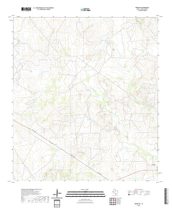
2022 Map of Freer NW
USGS Topo · Published 2022About this map
The arid plains of South Texas dominate this landscape north of Freer, where the drainage patterns of Soledad Cr and Government Wells Cr carve through the brush country. This area is characterized by a high concentration of livestock watering tanks, essential for ranching in this dry climate, including Piedra Tank, Cochina Tank, and Rincon Tank. These features, many bearing family or Spanish names, illustrate the enduring cattle-ranching heritage of the Duval County Ranch North-Lloyd-Tank region.
Find a feature on this map
21 named features on this map. Tap any name to fly to it.
Don’t see what you’re looking for? This feature index may not catch every label — zoom into the map to look around manually.
Map Details
Editions of this 2022 Freer NW Map
This is the sole edition of this map. No revisions or reprints were ever made.
Other maps of this area

1937 · Loma Alta
USGS Topo · 1:62,500

1953 · Crystal City
USGS Topo · 1:250,000

1955 · Crystal City
USGS Topo · 1:250,000

1956 · Freer
USGS Topo · 1:62,500

1956 · Piedra Creek
USGS Topo · 1:62,500

1956 · Las Mujeres
USGS Topo · 1:62,500

1956 · Laredo
USGS Topo · 1:250,000

1961 · Crystal City
USGS Topo · 1:250,000

1968 · Crystal City
USGS Topo · 1:250,000
1969 · Loma Alta
USGS Topo · 1:24,000