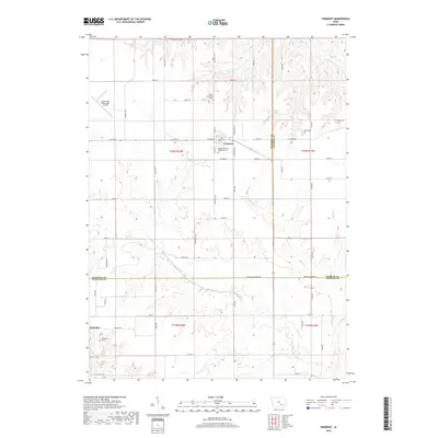
2018 Map of Fremont
USGS Topo · Published 2018About this map
Fremont sits at the intersection of several rural corridors, serving as a focal point for the surrounding agricultural landscape of Mahaska and Keokuk Counties. The town's layout is defined by W Main St and S Miles St, while its history is preserved in local sites like the Cedar Township Cem and the Cedar Township Memorial Cem. To the south, the terrain descends toward the winding path of Cedar Cr, where the small settlement of Kirkville is located near the Thompson Grave. This 2018 survey illustrates a highly organized section-line road network typical of the Iowa plains, punctuated by small family and township burial grounds such as Ford Cem and Helm Cem. The presence of the Oskaloosa Municipal Airport in the northwest corner highlights the area's continued role as a regional transportation hub, even as it maintains its deep-rooted rural character.
Find a feature on this map
59 named features on this map. Tap any name to fly to it.
Don’t see what you’re looking for? This feature index may not catch every label — zoom into the map to look around manually.
Map Details
Editions of this 2018 Fremont Map
This is the sole edition of this map. No revisions or reprints were ever made.
Other maps of this area

1954 · Des Moines
USGS Topo · 1:250,000

1956 · Des Moines
USGS Topo · 1:250,000

1956 · Farson
USGS Topo · 1:24,000

1956 · Ottumwa North
USGS Topo · 1:62,500

1956 · Ottumwa North
USGS Topo · 1:24,000

1957 · Des Moines
USGS Topo · 1:250,000

1965 · Rose Hill
USGS Topo · 1:24,000

1965 · Delta
USGS Topo · 1:24,000

1968 · University Park
USGS Topo · 1:24,000

1968 · Kirkville
USGS Topo · 1:24,000