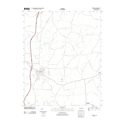
2010 Map of Fremont
USGS Topo · Published 2010About this map
Fremont and Eureka anchor this agricultural landscape in Wayne County, defined by a network of low-lying wetlands and family-named roads. The terrain is marked by a complex drainage system, including the Nahunta Swamp, Aycock Swamp, and the Great Swamp, which have historically dictated the placement of roads and farmsteads. These environmental features are interspersed with small-scale water management like the West Lake Dam, creating a hybrid landscape of natural bog and managed land.
Find a feature on this map
55 named features on this map. Tap any name to fly to it.
Don’t see what you’re looking for? This feature index may not catch every label — zoom into the map to look around manually.
Map Details
Editions of this 2010 Fremont Map
This is the sole edition of this map. No revisions or reprints were ever made.
Other maps of this area

1902 · Kenly
USGS Topo · 1:62,500

1903 · Kenly
USGS Topo · 1:62,500

1904 · Wilson
USGS Topo · 1:62,500

1953 · Rocky Mount
USGS Topo · 1:250,000

1953 · Raleigh
USGS Topo · 1:250,000

1954 · Rocky Mount
USGS Topo · 1:250,000

1954 · Raleigh
USGS Topo · 1:250,000

1957 · Goldsboro
USGS Topo · 1:62,500

1974 · Northwest Goldsboro
USGS Topo · 1:24,000
1978 · Lucama
USGS Topo · 1:24,000