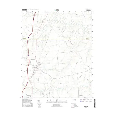
2016 Map of Fremont
USGS Topo · Published 2016About this map
Fremont stands as a central hub in northern Wayne County, where the grid of town streets meets the winding hydrology of the North Carolina coastal plain. The landscape is defined by an extensive network of blackwater drainage, including the broad Aycock Swamp and Nahunta Swamp which thread through the agricultural acreage. To the east, the settlement of Eureka sits near the edge of Turner Swamp, while Pikeville occupies the southwestern corner of the quadrangle. This 2016 survey illustrates the persistent rural character of the region, where family-named routes like Herman Hooks Rd and Aycock Church Rd connect scattered homesteads. Notable landmarks for local historians include Elmwood Cem and New Daniels Chapel Rd, reflecting the deep-rooted community foundations established along these fertile lowlands.
Find a feature on this map
80 named features on this map. Tap any name to fly to it.
Don’t see what you’re looking for? This feature index may not catch every label — zoom into the map to look around manually.
Map Details
Editions of this 2016 Fremont Map
This is the sole edition of this map. No revisions or reprints were ever made.
Other maps of this area

1902 · Kenly
USGS Topo · 1:62,500

1903 · Kenly
USGS Topo · 1:62,500

1904 · Wilson
USGS Topo · 1:62,500

1953 · Rocky Mount
USGS Topo · 1:250,000

1953 · Raleigh
USGS Topo · 1:250,000

1954 · Rocky Mount
USGS Topo · 1:250,000

1954 · Raleigh
USGS Topo · 1:250,000

1957 · Goldsboro
USGS Topo · 1:62,500

1974 · Northwest Goldsboro
USGS Topo · 1:24,000
1978 · Lucama
USGS Topo · 1:24,000