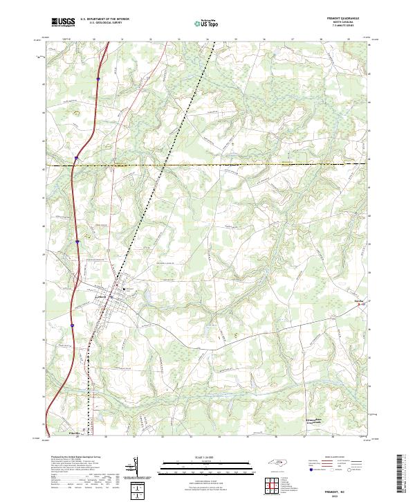
2022 Map of Fremont
USGS Topo · Published 2022About this map
Fremont sits at the heart of this agricultural landscape along the boundary of Wilson and Wayne counties. The town's grid is surrounded by extensive wetlands and drainage systems, including the wide Aycock Swamp to the south and Great Swamp to the north. These natural features, alongside Nahunta Swamp and Turner Swamp, define the local topography and historically dictated the placement of early roads and settlements. Local history and genealogy are anchored by landmarks like Elmwood Cem and smaller outlying communities such as Eureka, Pikeville, and Edmundson Crossroads. The network of country lanes, including Frank Price Church Rd and Slabtown Rd, connect the rural homesteads and farms that have shaped the region's character for generations.
Find a feature on this map
89 named features on this map. Tap any name to fly to it.
Don’t see what you’re looking for? This feature index may not catch every label — zoom into the map to look around manually.
Map Details
Editions of this 2022 Fremont Map
This is the sole edition of this map. No revisions or reprints were ever made.
Other maps of this area

1902 · Kenly
USGS Topo · 1:62,500

1903 · Kenly
USGS Topo · 1:62,500

1904 · Wilson
USGS Topo · 1:62,500

1953 · Rocky Mount
USGS Topo · 1:250,000

1953 · Raleigh
USGS Topo · 1:250,000

1954 · Rocky Mount
USGS Topo · 1:250,000

1954 · Raleigh
USGS Topo · 1:250,000

1957 · Goldsboro
USGS Topo · 1:62,500

1974 · Northwest Goldsboro
USGS Topo · 1:24,000
1978 · Lucama
USGS Topo · 1:24,000