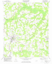
1978 Map of Fremont
USGS Topo · Published 1978About this map
Fremont and its surrounding coastal plain settlements are captured here in the late 1970s, defined by a landscape of sprawling wetlands and rural communities. The Seaboard Coast Line railroad serves as the primary north-south spine, connecting the town center to the edge of Pikeville while bypassing the dense vegetation of Great Swamp. This period shows a robust local network of rural institutions, particularly along the winding courses of Aycock Swamp and Nahunta Swamp.
Find a feature on this map
28 named features on this map. Tap any name to fly to it.
Don’t see what you’re looking for? This feature index may not catch every label — zoom into the map to look around manually.
Map Details
Editions of this 1978 Fremont Map
This is the sole edition of this map. No revisions or reprints were ever made.
Other maps of this area

1902 · Kenly
USGS Topo · 1:62,500

1903 · Kenly
USGS Topo · 1:62,500

1904 · Wilson
USGS Topo · 1:62,500

1953 · Rocky Mount
USGS Topo · 1:250,000

1953 · Raleigh
USGS Topo · 1:250,000

1954 · Rocky Mount
USGS Topo · 1:250,000

1954 · Raleigh
USGS Topo · 1:250,000

1957 · Goldsboro
USGS Topo · 1:62,500

1974 · Northwest Goldsboro
USGS Topo · 1:24,000
1978 · Lucama
USGS Topo · 1:24,000