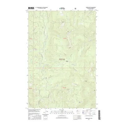
2017 Map of French Butte
USGS Topo · Published 2017About this map
Gifford Pinchot National Forest dominates this high-elevation region of Washington, defined by a complex network of forest development roads that connect isolated peaks and mountain meadows. High points like French Butte, Pinto Rock, and Badger Peak serve as primary landmarks for navigation through the dense drainage basins of Iron Creek and Pinto Creek. The landscape is a study in forest management and recreational land use, featuring specific locales such as Mosquito Meadows and Snyder Pasture alongside prominent geological formations like The Loaf and Kirk Rock. A series of forest roads, including Nat For Dev Rd 77 and Nat For Dev Rd 28, provide the primary access through this timber-rich terrain, crossing over Elk Pass and following the many creek beds that feed the regional watershed.
Find a feature on this map
55 named features on this map. Tap any name to fly to it.
Don’t see what you’re looking for? This feature index may not catch every label — zoom into the map to look around manually.
Map Details
Editions of this 2017 French Butte Map
This is the sole edition of this map. No revisions or reprints were ever made.
Other maps of this area

1919 · Mount St Helens
USGS Topo · 1:125,000

1926 · Steamboat Mtn
USGS Topo · 1:125,000

1931 · Steamboat Mtn
USGS Topo · 1:125,000

1950 · Yakima
USGS Topo · 1:250,000

1953 · Hoquiam
USGS Topo · 1:250,000

1957 · Hoquiam
USGS Topo · 1:250,000

1957 · Spirit Lake
USGS Topo · 1:62,500

1958 · Mt St. Helens
USGS Topo · 1:62,500

1958 · Yakima
USGS Topo · 1:250,000

1958 · Hoquiam
USGS Topo · 1:250,000