
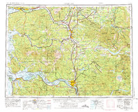
1958 Map of Hoquiam
USGS Topo · Published 1969About this map
Grays Harbor and the Columbia River anchor this 1958 survey, capturing the industrial and maritime character of Southwest Washington and Northwest Oregon. The map illustrates a landscape dominated by timber and transport, where the Northern Pacific and Union Pacific railroads intersect with burgeoning hubs like Hoquiam, Aberdeen, and Centralia. In the east, the volcanic presence of Mt St Helens looms over the Gifford Pinchot National Forest, while the massive Fort Lewis Military Reservation occupies the northern reaches.
Find a feature on this map
112 named features on this map. Tap any name to fly to it.
Don’t see what you’re looking for? This feature index may not catch every label — zoom into the map to look around manually.
Map Details
Editions of this 1958 Hoquiam Map
2 editions found
Other maps of this area

1897 · Tacoma
USGS Topo · 1:125,000

1900 · Tacoma
USGS Topo · 1:125,000

1913 · Cedar Lake
USGS Topo · 1:125,000

1916 · Chehalis
USGS Topo · 1:125,000

1919 · Mayger
USGS Topo · 1:62,500

1919 · Mount St Helens
USGS Topo · 1:125,000

1919 · Astoria
USGS Topo · 1:62,500

1921 · Kalama
USGS Topo · 1:62,500

1922 · St. Helens
USGS Topo · 1:62,500

1924 · Mt Rainier
USGS Topo · 1:96,000