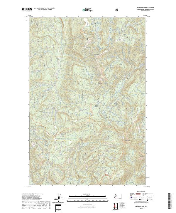
2023 Map of French Butte
USGS Topo · Published 2023About this map
Gifford Pinchot National Forest dominates this section of the Cascade Range, characterized by a complex network of ridges and glacial drainages. Named summits like French Butte and Badger Peak define the high ground, while lower elevations are marked by the seasonally significant Mosquito Meadows and Snyder Pasture. The map illustrates the specialized backcountry access required for this terrain, highlighting routes such as the Randle-Lewis River road and the high-elevation Elk Pass.
Find a feature on this map
37 named features on this map. Tap any name to fly to it.
Don’t see what you’re looking for? This feature index may not catch every label — zoom into the map to look around manually.
Map Details
Editions of this 2023 French Butte Map
This is the sole edition of this map. No revisions or reprints were ever made.
Other maps of this area

1919 · Mount St Helens
USGS Topo · 1:125,000

1926 · Steamboat Mtn
USGS Topo · 1:125,000

1931 · Steamboat Mtn
USGS Topo · 1:125,000

1950 · Yakima
USGS Topo · 1:250,000

1953 · Hoquiam
USGS Topo · 1:250,000

1957 · Hoquiam
USGS Topo · 1:250,000

1957 · Spirit Lake
USGS Topo · 1:62,500

1958 · Mt St. Helens
USGS Topo · 1:62,500

1958 · Yakima
USGS Topo · 1:250,000

1958 · Hoquiam
USGS Topo · 1:250,000