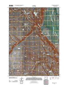
2011 Map of Frenchglen
USGS Topo · Published 2011About this map
Frenchglen serves as the focal point for this high-desert landscape in Harney County, situated at the base of the Steens Mountain foothills. The area is defined by the vital waters of the Donner und Blitzen River and the historical ranching infrastructure of the P Ranch. This map details a complex network of water management features essential for survival in the arid terrain, including the Warm Springs Canal, Griffith Spring Reservoir, and numerous waterholes such as Broadgate Waterhole and Mustang Waterhole. Evidence of the region’s long-standing cattle-ranching heritage is visible through landmarks like Pickett Corrals and the Brenton Cabin. While the settlement of Frenchglen remains the primary hub with its Frenchglen Post Office, the surrounding geography is dominated by natural landmarks like P Hill and the seasonal flows of Dry Creek.
Find a feature on this map
24 named features on this map. Tap any name to fly to it.
Don’t see what you’re looking for? This feature index may not catch every label — zoom into the map to look around manually.
Map Details
Editions of this 2011 Frenchglen Map
This is the sole edition of this map. No revisions or reprints were ever made.
Other maps of this area

1955 · Adel
USGS Topo · 1:250,000

1957 · Adel
USGS Topo · 1:250,000

1958 · Adel
USGS Topo · 1:250,000

1962 · Adel
USGS Topo · 1:250,000

1967 · Krumbo Reservoir
USGS Topo · 1:24,000

1967 · Roaring Springs
USGS Topo · 1:24,000

1967 · Frenchglen
USGS Topo · 1:24,000
1967 · Irish Lake
USGS Topo · 1:24,000

1967 · Page Springs
USGS Topo · 1:24,000

1968 · Tombstone Canyon
USGS Topo · 1:24,000