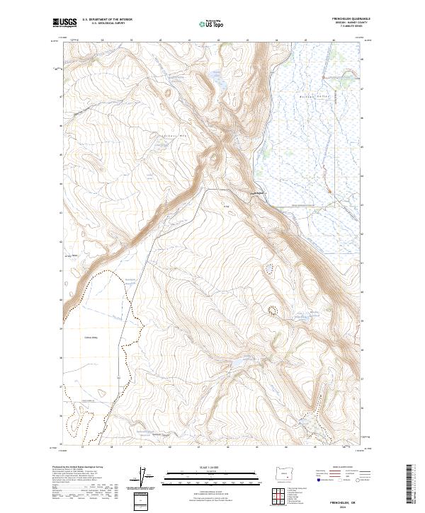
2024 Map of Frenchglen
USGS Topo · Published 2024About this map
Frenchglen sits at the base of the western slope where the High Desert meets the marshy expanses of the Blitzen Valley. This landscape is defined by its sophisticated water management, featuring a network of man-made structures like the Bridge Creek Canal, Warm Springs Canal, and numerous reservoirs such as Griffith Spring Reservoir and Kundert Reservoir. These features suggest a history of reclaiming the arid terrain for agricultural or livestock use, even as large portions remain dedicated to conservation within the Malheur National Wildlife Refuge. The terrain transitions sharply from the lowlands of the Catlow Valley to prominent peaks and tables, including the distinctly named Jackass Mtn and P Hill. The presence of the Donner und Blitzen River and various waterholes like Colt Waterhole highlights the critical importance of water sources in this isolated section of Harney County.
Find a feature on this map
35 named features on this map. Tap any name to fly to it.
Don’t see what you’re looking for? This feature index may not catch every label — zoom into the map to look around manually.
Map Details
Editions of this 2024 Frenchglen Map
This is the sole edition of this map. No revisions or reprints were ever made.
Other maps of this area

1955 · Adel
USGS Topo · 1:250,000

1957 · Adel
USGS Topo · 1:250,000

1958 · Adel
USGS Topo · 1:250,000

1962 · Adel
USGS Topo · 1:250,000

1967 · Krumbo Reservoir
USGS Topo · 1:24,000

1967 · Roaring Springs
USGS Topo · 1:24,000

1967 · Frenchglen
USGS Topo · 1:24,000
1967 · Irish Lake
USGS Topo · 1:24,000

1967 · Page Springs
USGS Topo · 1:24,000

1968 · Tombstone Canyon
USGS Topo · 1:24,000