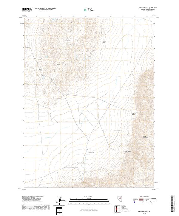
2021 Map of Frenchie Flat
USGS Topo · Published 2021About this map
Frenchie Flat sits at the heart of this high-desert landscape in central Nevada, bounded by the steep rises of the Cortez Mountains to the southeast. The terrain is defined by a network of drainage systems and isolated water sources essential for life in this arid basin, including Thomas Cr, Frenchie Cr, and several named springs such as Four Tanks Spring and Colburn Spring. The presence of Willow Corral Pass and Pony Trail Canyon suggests a history of trans-basin travel and grazing, while the vast expanse of Crescent Valley dominates the northeastern corner. This U.S. Geological Survey representation provides a clear view of the complex topography between Scotts Gulch and the Dry Hills, documenting the critical relationship between intermittent water and the accessible passes through the high ridges.
Find a feature on this map
19 named features on this map. Tap any name to fly to it.
Don’t see what you’re looking for? This feature index may not catch every label — zoom into the map to look around manually.
Map Details
Editions of this 2021 Frenchie Flat Map
This is the sole edition of this map. No revisions or reprints were ever made.
Other maps of this area

1952 · Pine Valley
USGS Topo · 1:62,500

1952 · Carlin
USGS Topo · 1:62,500

1955 · Winnemucca
USGS Topo · 1:250,000

1957 · Frenchie Creek
USGS Topo · 1:62,500

1957 · Beowawe
USGS Topo · 1:62,500

1958 · Winnemucca
USGS Topo · 1:250,000

1962 · Winnemucca
USGS Topo · 1:250,000
1985 · Thatcher Spring
USGS Topo · 1:24,000
1985 · Hand-Me-Down Creek
USGS Topo · 1:24,000

1985 · Scotts Gulch
USGS Topo · 1:24,000