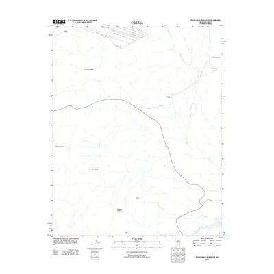
2012 Map of Frenchman Mountain
USGS Topo · Published 2012About this map
Frenchman Mountain and Sunrise Mountain dominate this Nevada landscape, anchoring the rugged topography east of the metropolitan basin. The 2012 survey illustrates the intersection of natural desert drainage systems, such as Gypsum Wash and Lava Butte Wash, with the encroaching infrastructure of the surrounding valley. The presence of Rainbow Gardens suggests a distinct geological character near Lava Butte, while a small grid of streets including 1st St and 8th St marks a pocket of development near Perimeter Rd. Modern transportation corridors like Lake Meade Blvd bisect the arid terrain, leading toward the edge of Lake Mead. This map serves as a record of the desert's character before further suburban expansion, tracing the paths of the Frenchman Range and the hydraulic network flowing toward the Las Vegas Wash.
Find a feature on this map
22 named features on this map. Tap any name to fly to it.
Don’t see what you’re looking for? This feature index may not catch every label — zoom into the map to look around manually.
Map Details
Editions of this 2012 Frenchman Mountain Map
This is the sole edition of this map. No revisions or reprints were ever made.
Other maps of this area

1886 · Saint Thomas
USGS Topo · 1:250,000

1893 · Saint Thomas
USGS Topo · 1:250,000

1907 · Las Vegas
USGS Topo · 1:250,000

1908 · Las Vegas
USGS Topo · 1:250,000

1926 · Boulder Canyon
USGS Topo · 1:96,000

1952 · Gass Peak
USGS Topo · 1:62,500

1952 · Dry Lake
USGS Topo · 1:62,500

1952 · Henderson
USGS Topo · 1:62,500

1952 · Las Vegas
USGS Topo · 1:62,500

1954 · Las Vegas
USGS Topo · 1:250,000