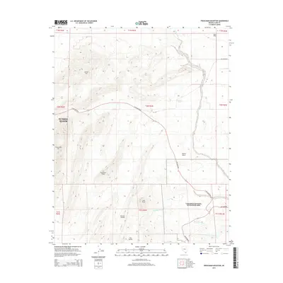
2014 Map of Frenchman Mountain
USGS Topo · Published 2014About this map
Sunrise Mtn and the Frenchman Range dominate this desert landscape east of the developing suburban edge at Sunrise Manor. This 2014 survey captures a moment of topographical clarity in the Mojave Desert, where the stark transition from urban growth to the protected expanse of the Lake Mead National Recreation Area is clearly defined. Notable geological landmarks like Lava Butte and the Gale Hills rise above the complex network of drainage washes, including Gypsum Wash and Lava Butte Wash. The map traces primary access routes such as E Lake Mead Blvd and Northshore Rd, providing essential context for the area's hydrology and land management boundaries during the early 21st century. Significant features like Gypsum Spring and the Rainbow Gardens area offer specific points of interest for those studying the intersection of geology and local topography in Clark County.
Find a feature on this map
24 named features on this map. Tap any name to fly to it.
Don’t see what you’re looking for? This feature index may not catch every label — zoom into the map to look around manually.
Map Details
Editions of this 2014 Frenchman Mountain Map
This is the sole edition of this map. No revisions or reprints were ever made.
Other maps of this area

1886 · Saint Thomas
USGS Topo · 1:250,000

1893 · Saint Thomas
USGS Topo · 1:250,000

1907 · Las Vegas
USGS Topo · 1:250,000

1908 · Las Vegas
USGS Topo · 1:250,000

1926 · Boulder Canyon
USGS Topo · 1:96,000

1952 · Gass Peak
USGS Topo · 1:62,500

1952 · Dry Lake
USGS Topo · 1:62,500

1952 · Henderson
USGS Topo · 1:62,500

1952 · Las Vegas
USGS Topo · 1:62,500

1954 · Las Vegas
USGS Topo · 1:250,000