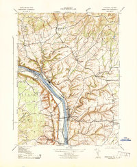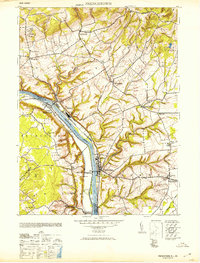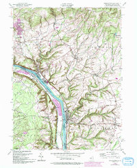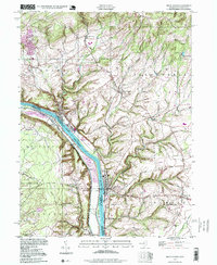
2023 Map of Frenchtown
USGS Topo · Published 2023About this map
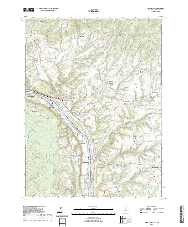
Frenchtown and Milford anchor this contemporary survey of the riverfront corridor where Hunterdon County, New Jersey, meets Bucks County, Pennsylvania. The Delaware River serves as the central artery, flanked by historic river crossings and small crossroad settlements including Upper Black Eddy, Uhlerstown, and Erwinna. The landscape transitions from the river flats toward the elevations of Musconetcong Mountain and Riegel Ridge in the north, punctuated by numerous stream valleys such as Nishisakawick Creek and Hakihokake Creek. For local historians and genealogists, the map identifies several significant burial sites, from the Milford Union Cem and Alexandria Cem to the family-specific Pursell Burying Ground and Erwin Family Cem. The transportation network is defined by old county roads and modern recreational corridors like the Feeder Canal Trl and D&L Trl, reflecting the area's evolution from a canal and river trade hub to a contemporary residential and rural landscape.
Find a feature on this map
44 named features on this map. Tap any name to fly to it.
Don’t see what you’re looking for? This feature index may not catch every label — zoom into the map to look around manually.
Map Details
Editions of this 2023 Frenchtown Map
This is the sole edition of this map. No revisions or reprints were ever made.
Historical Maps of Upper Black Eddy Through Time
5 maps found