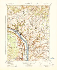
1943 Map of Frenchtown
USGS Topo · Published 1943About this map
The Delaware River serves as the central axis for this landscape during the early 1940s, separating the river towns of Frenchtown and Milford in New Jersey from their Pennsylvania counterparts, Uhlerstown and Upper Black Eddy. The Pennsylvania Railroad (Belvidere Division) traces the eastern bank, supporting a corridor of local industry represented by the Power & Light Station and numerous local mills.
Find a feature on this map
48 named features on this map. Tap any name to fly to it.
Don’t see what you’re looking for? This feature index may not catch every label — zoom into the map to look around manually.
Map Details
Editions of this 1943 Frenchtown Map
This is the sole edition of this map. No revisions or reprints were ever made.
Other maps of this area

1890 · Easton
USGS Topo · 1:62,500

1890 · High Bridge
USGS Topo · 1:62,500

1890 · Lambertville
USGS Topo · 1:62,500

1890 · Doylestown
USGS Topo · 1:62,500

1891 · Easton
USGS Topo · 1:62,500

1891 · Lambertville
USGS Topo · 1:62,500

1891 · Doylestown
USGS Topo · 1:62,500

1894 · Lambertville
USGS Topo · 1:62,500

1898 · High Bridge
USGS Topo · 1:62,500

1900 · Raritan
USGS Topo · 1:125,000