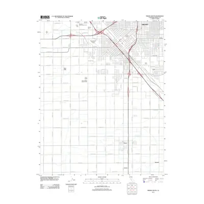
2012 Map of Fresno South
USGS Topo · Published 2012About this map
The Fresno-Chandler Downtown Airport and a dense cluster of historic cemeteries anchor the northwestern landscape of this southern Fresno quadrangle. A series of sacred grounds including Saint Peters Cem, Mountain View Cem, and the Independent Order of Oddfellows Cem reflect the region's deep lineage. The landscape transitions from the urban core and the Old Fresno Water Tower to industrial and agricultural hubs such as the Cribari Winery in Calwa. Moving south, the grid-patterned terrain is marked by smaller settlements like Easton and Oleander, where the Washington Colony Cem sits among fields irrigated by the Braley Canal. This survey captures the specialized infrastructure of the San Joaquin Valley, from the Fresno Sanitary Landfill to the complex intersection of state highways and local avenues.
Find a feature on this map
86 named features on this map. Tap any name to fly to it.
Don’t see what you’re looking for? This feature index may not catch every label — zoom into the map to look around manually.
Map Details
Editions of this 2012 Fresno South Map
This is the sole edition of this map. No revisions or reprints were ever made.
Other maps of this area

1921 · Bullard
USGS Topo · 1:31,680

1923 · Kearney Park
USGS Topo · 1:31,680

1923 · Malaga
USGS Topo · 1:31,680

1923 · Herndon
USGS Topo · 1:31,680

1923 · Fresno
USGS Topo · 1:31,680

1923 · Clovis
USGS Topo · 1:31,680

1923 · Bullard
USGS Topo · 1:31,680

1924 · Conejo
USGS Topo · 1:31,680

1925 · Raisin
USGS Topo · 1:31,680

1925 · Caruthers
USGS Topo · 1:31,680