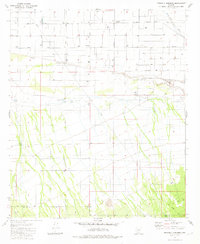
1981 Map of Friendly Corners
USGS Topo · Published 1981About this map
Friendly Corners sits at the intersection of agricultural industry and the desert floor in this early 1980s portrait of south-central Arizona. The landscape is defined by the managed flow of water through the Greene Canal and the northern reaches of the Santa Cruz River, which cuts through the northeastern corner of the map. This area shows a transition from the structured grid of rural irrigation to the open desert near the boundary of Pinal Co and Pima Co.
Find a feature on this map
20 named features on this map. Tap any name to fly to it.
Don’t see what you’re looking for? This feature index may not catch every label — zoom into the map to look around manually.
Map Details
Editions of this 1981 Friendly Corners Map
2 editions found
Other maps of this area

1934 · Tucson Mountains
USGS Topo · 1:125,000

1934 · Silver Bell
USGS Topo · 1:125,000

1934 · Newman Peak
USGS Topo · 1:125,000

1947 · Red Rock
USGS Topo · 1:62,500

1947 · Eloy
USGS Topo · 1:62,500

1948 · Eloy
USGS Topo · 1:62,500

1956 · Tucson
USGS Topo · 1:250,000

1958 · Tucson
USGS Topo · 1:250,000

1959 · Tucson
USGS Topo · 1:250,000

1959 · Vaca Hills
USGS Topo · 1:62,500