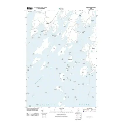
2011 Map of Friendship
USGS Topo · Published 2011About this map
Friendship serves as a central hub for this coastal stretch of Maine, where the Meduncook River and Saint George River meet the Atlantic Ocean. The geography is defined by a dense archipelago of islands and ledges, including the prominent Friendship Long Island and Caldwell Island, which protect the inner waters of Muscongus Bay. Along the shoreline, historical points of interest for genealogists include Wayside Cemetery and Harbor Cemetery, alongside small coastal settlements like Glenmere and Port Clyde.
Find a feature on this map
129 named features on this map. Tap any name to fly to it.
Don’t see what you’re looking for? This feature index may not catch every label — zoom into the map to look around manually.
Map Details
Editions of this 2011 Friendship Map
This is the sole edition of this map. No revisions or reprints were ever made.
Other maps of this area

1904 · Monhegan
USGS Topo · 1:62,500

1904 · Tenants Harbor
USGS Topo · 1:62,500

1904 · Rockland
USGS Topo · 1:62,500

1906 · Tennant Harbor
USGS Topo · 1:62,500

1906 · Monhegan
USGS Topo · 1:62,500

1906 · Rockland
USGS Topo · 1:62,500

1913 · Waldoboro
USGS Topo · 1:48,000

1915 · Waldoboro
USGS Topo · 1:62,500

1941 · Rockland
USGS Topo · 1:62,500

1941 · Waldoboro
USGS Topo · 1:62,500