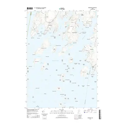
2014 Map of Friendship
USGS Topo · Published 2014About this map
Friendship and the neighboring coastal settlements of Pleasant Point and Port Clyde define this mid-coast Maine landscape where the Meduncook River and Saint George River meet the Atlantic Ocean. The map reveals a deeply indented shoreline shaped by tidal coves such as Hatchet Cove and Hornbarn Cove, interspersed with historical burial grounds including Harbor Cem and Village Cem. This 2014 survey captures the coastal community structure just before the middle of the decade, showing the intricate network of local roads like Davis Point Rd and Cushing Rd that connect isolated points of land.
Find a feature on this map
159 named features on this map. Tap any name to fly to it.
Don’t see what you’re looking for? This feature index may not catch every label — zoom into the map to look around manually.
Map Details
Editions of this 2014 Friendship Map
This is the sole edition of this map. No revisions or reprints were ever made.
Other maps of this area

1904 · Monhegan
USGS Topo · 1:62,500

1904 · Tenants Harbor
USGS Topo · 1:62,500

1904 · Rockland
USGS Topo · 1:62,500

1906 · Tennant Harbor
USGS Topo · 1:62,500

1906 · Monhegan
USGS Topo · 1:62,500

1906 · Rockland
USGS Topo · 1:62,500

1913 · Waldoboro
USGS Topo · 1:48,000

1915 · Waldoboro
USGS Topo · 1:62,500

1941 · Rockland
USGS Topo · 1:62,500

1941 · Waldoboro
USGS Topo · 1:62,500