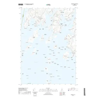
2018 Map of Friendship
USGS Topo · Published 2018About this map
Friendship Harbor and the Meduncook River define this coastal reach of Knox County, where the transition from tidal estuaries to the open sea is marked by an intricate network of ledges and islands. The settlement of Friendship serves as a focal point, surrounded by historic burial grounds like Wayside Cem and Village Cem that speak to generations of local families. To the east, the Saint George River flows past South Cushing and Pleasant Point, leading toward the harbor at Port Clyde. The landscape is etched with local names and landmarks, from Jameson Point to the small harbor at Martin. This modern survey documents the contemporary roads, such as Hathorne Point Rd and Seaside Farm Dr, that now connect these long-established maritime communities along the Atlantic shoreline.
Find a feature on this map
157 named features on this map. Tap any name to fly to it.
Don’t see what you’re looking for? This feature index may not catch every label — zoom into the map to look around manually.
Map Details
Editions of this 2018 Friendship Map
This is the sole edition of this map. No revisions or reprints were ever made.
Other maps of this area

1904 · Monhegan
USGS Topo · 1:62,500

1904 · Tenants Harbor
USGS Topo · 1:62,500

1904 · Rockland
USGS Topo · 1:62,500

1906 · Tennant Harbor
USGS Topo · 1:62,500

1906 · Monhegan
USGS Topo · 1:62,500

1906 · Rockland
USGS Topo · 1:62,500

1913 · Waldoboro
USGS Topo · 1:48,000

1915 · Waldoboro
USGS Topo · 1:62,500

1941 · Rockland
USGS Topo · 1:62,500

1941 · Waldoboro
USGS Topo · 1:62,500