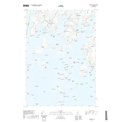
2021 Map of Friendship
USGS Topo · Published 2021About this map
Friendship serves as a central hub for this coastal Maine landscape, where the irregular granite shoreline of Muscongus Bay meets the deep waters of the Meduncook River. The 2021 topography reveals a community shaped by maritime geography, from the busy waters of Friendship Harbor to the outlying reaches of Friendship Long Island. Numerous burial grounds, including the Old Village Cem and Harbor Cem, provide valuable geographic markers for genealogists tracing local families. To the east, the peninsula narrows toward Port Clyde, a historic gateway where the mainland ends at Marshall Point. The map captures the density of private roads and lanes like Maple Juice Ln and Smugglers Cove Rd, reflecting the long-standing transition of these coastal points from traditional fishing outposts to residential and seasonal settlements while maintaining the navigational landmarks of the Saint George River.
Find a feature on this map
161 named features on this map. Tap any name to fly to it.
Don’t see what you’re looking for? This feature index may not catch every label — zoom into the map to look around manually.
Map Details
Editions of this 2021 Friendship Map
This is the sole edition of this map. No revisions or reprints were ever made.
Other maps of this area

1904 · Monhegan
USGS Topo · 1:62,500

1904 · Tenants Harbor
USGS Topo · 1:62,500

1904 · Rockland
USGS Topo · 1:62,500

1906 · Tennant Harbor
USGS Topo · 1:62,500

1906 · Monhegan
USGS Topo · 1:62,500

1906 · Rockland
USGS Topo · 1:62,500

1913 · Waldoboro
USGS Topo · 1:48,000

1915 · Waldoboro
USGS Topo · 1:62,500

1941 · Rockland
USGS Topo · 1:62,500

1941 · Waldoboro
USGS Topo · 1:62,500