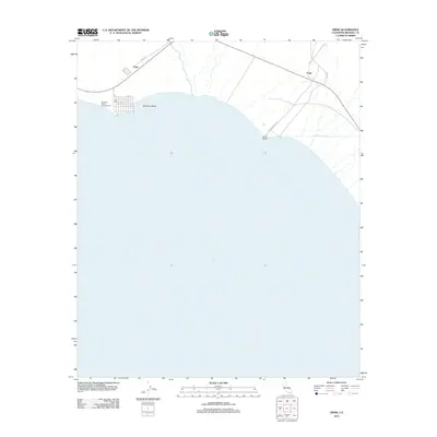
2012 Map of Frink
USGS Topo · Published 2012About this map
The eastern shoreline of the Salton Sea dominates this southern California landscape, where the water's edge meets the desert floor at the northern end of Imperial County. The community of Bombay Beach sits right at the waterline, its grid of streets from A St to H St tucked behind the Bombay Beach Campground. This 2012 survey illustrates the relationship between the receding sea and the vital irrigation infrastructure of the Coachella and Imperial Valleys, most notably the East Highline Canal running along the eastern edge.
Find a feature on this map
20 named features on this map. Tap any name to fly to it.
Don’t see what you’re looking for? This feature index may not catch every label — zoom into the map to look around manually.
Map Details
Editions of this 2012 Frink Map
This is the sole edition of this map. No revisions or reprints were ever made.
Other maps of this area

1940 · Kane Spring
USGS Topo · 1:62,500

1940 · Frink
USGS Topo · 1:62,500

1940 · Durmid
USGS Topo · 1:62,500

1944 · Durmid
USGS Topo · 1:62,500

1944 · Kane Spring
USGS Topo · 1:62,500

1944 · Calipatria
USGS Topo · 1:62,500

1944 · Frink
USGS Topo · 1:62,500

1954 · Salton Sea
USGS Topo · 1:250,000

1955 · Salton Sea
USGS Topo · 1:250,000

1956 · Frink NW
USGS Topo · 1:24,000