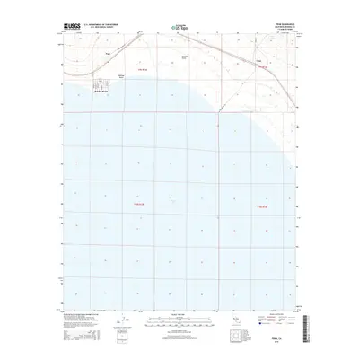
2015 Map of Frink
USGS Topo · Published 2015About this map
Bombay Beach sits on the eastern shore of the Salton Sea, defined by a grid of streets like Avenue A and Aisle of Palms. This low-lying desert landscape within the Imperial Valley shows the intersection of sparse settlement and critical water infrastructure. To the north, the small locations of Pope and Frink align with the regional transportation corridor, while the E Highline Canal cuts across the arid terrain to the east. The presence of Frink Spring near the northeastern corner suggests an older water source in this harsh environment. The survey captures the unique topography where the desert floor meets the rising waters of the inland sea, recording a moment in the modern history of these distinctive Imperial County communities.
Find a feature on this map
23 named features on this map. Tap any name to fly to it.
Don’t see what you’re looking for? This feature index may not catch every label — zoom into the map to look around manually.
Map Details
Editions of this 2015 Frink Map
This is the sole edition of this map. No revisions or reprints were ever made.
Other maps of this area

1940 · Kane Spring
USGS Topo · 1:62,500

1940 · Frink
USGS Topo · 1:62,500

1940 · Durmid
USGS Topo · 1:62,500

1944 · Durmid
USGS Topo · 1:62,500

1944 · Kane Spring
USGS Topo · 1:62,500

1944 · Calipatria
USGS Topo · 1:62,500

1944 · Frink
USGS Topo · 1:62,500

1954 · Salton Sea
USGS Topo · 1:250,000

1955 · Salton Sea
USGS Topo · 1:250,000

1956 · Frink NW
USGS Topo · 1:24,000