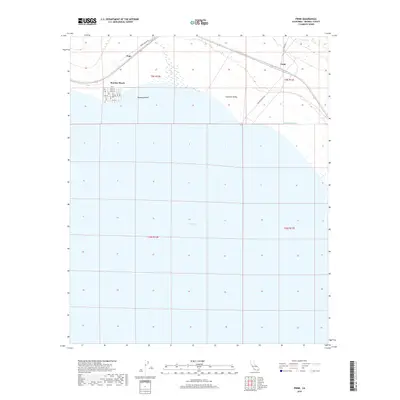
2018 Map of Frink
USGS Topo · Published 2018About this map
The eastern shoreline of the Salton Sea dominates this Imperial County landscape, where the desert meets the inland sea. The small community of Bombay Beach is detailed with its organized street grid, ranging from Ave A to Ave H, sitting just above the water's edge. This 2018 survey captures the region's sparse but significant infrastructure, including the E Highline Canal and the localized settlements of Pope and Frink. The transition from the lower elevations of the Imperial Valley to the surrounding desert is marked by distinctive features like Frink Spring, reflecting the essential role of water sources in this arid environment. Transportation through this remote stretch is defined by specific access points such as Niland Marina Rd and the uniquely named Honey Wagon Rd.
Find a feature on this map
27 named features on this map. Tap any name to fly to it.
Don’t see what you’re looking for? This feature index may not catch every label — zoom into the map to look around manually.
Map Details
Editions of this 2018 Frink Map
This is the sole edition of this map. No revisions or reprints were ever made.
Other maps of this area

1940 · Kane Spring
USGS Topo · 1:62,500

1940 · Frink
USGS Topo · 1:62,500

1940 · Durmid
USGS Topo · 1:62,500

1944 · Durmid
USGS Topo · 1:62,500

1944 · Kane Spring
USGS Topo · 1:62,500

1944 · Calipatria
USGS Topo · 1:62,500

1944 · Frink
USGS Topo · 1:62,500

1954 · Salton Sea
USGS Topo · 1:250,000

1955 · Salton Sea
USGS Topo · 1:250,000

1956 · Frink NW
USGS Topo · 1:24,000