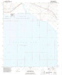
1992 Map of Frink
USGS Topo · Published 1995About this map
The Salton Sea dominates this corner of the Imperial Valley, where the shoreline meets a landscape of desert infrastructure and early recreation development. Along the water's edge, the planned grid of Bombay Beach stands in contrast to the more utilitarian settlements of Pope and Frink to the north. These sites are tied closely to the transportation corridor running parallel to the shore, where a Landing Strip and various resource extraction sites like a Gravel Pit and Quarry indicate the area's mid-century economic activity. Water remains the most critical resource in this arid environment, evidenced by the presence of Frink Spring. The map also highlights the establishment of public lands, specifically the Salton Sea State Recreation Area and Niland County Park, marking the transition of the shoreline from a purely industrial or agricultural buffer into a destination for desert tourism.
Find a feature on this map
13 named features on this map. Tap any name to fly to it.
Don’t see what you’re looking for? This feature index may not catch every label — zoom into the map to look around manually.
Map Details
Editions of this 1992 Frink Map
This is the sole edition of this map. No revisions or reprints were ever made.
Other maps of this area

1940 · Kane Spring
USGS Topo · 1:62,500

1940 · Frink
USGS Topo · 1:62,500

1940 · Durmid
USGS Topo · 1:62,500

1944 · Durmid
USGS Topo · 1:62,500

1944 · Kane Spring
USGS Topo · 1:62,500

1944 · Calipatria
USGS Topo · 1:62,500

1944 · Frink
USGS Topo · 1:62,500

1954 · Salton Sea
USGS Topo · 1:250,000

1955 · Salton Sea
USGS Topo · 1:250,000

1956 · Frink NW
USGS Topo · 1:24,000