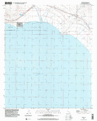
1998 Map of Frink
USGS Topo · Published 2002About this map
The Salton Sea dominates this landscape on the eastern shore of Imperial County, California. Along the waterline, the settlement of Bombay Beach sits just south of Pope, providing a clear look at the residential grid and shoreline infrastructure as it existed in the late 1990s. The inland area to the northeast is defined by industrial and recreational sites, including a Landing Strip near Frink and several Gravel Pit and Quarry operations. Public lands are well-represented by the Salton Sea State Recreation Area and Niland County Park, which border the water. The presence of Frink Spring and another unnamed Spring near the rugged terrain of the northeast suggests the vital importance of water sources in this desert environment, even alongside the massive inland sea. This edition reflects topography compiled in 1953 with planimetric updates from 1992 and 1998 imagery.
Find a feature on this map
13 named features on this map. Tap any name to fly to it.
Don’t see what you’re looking for? This feature index may not catch every label — zoom into the map to look around manually.
Map Details
Editions of this 1998 Frink Map
This is the sole edition of this map. No revisions or reprints were ever made.
Other maps of this area

1940 · Kane Spring
USGS Topo · 1:62,500

1940 · Frink
USGS Topo · 1:62,500

1940 · Durmid
USGS Topo · 1:62,500

1944 · Durmid
USGS Topo · 1:62,500

1944 · Kane Spring
USGS Topo · 1:62,500

1944 · Calipatria
USGS Topo · 1:62,500

1944 · Frink
USGS Topo · 1:62,500

1954 · Salton Sea
USGS Topo · 1:250,000

1955 · Salton Sea
USGS Topo · 1:250,000

1956 · Frink NW
USGS Topo · 1:24,000