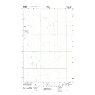
2011 Map of Froid
USGS Topo · Published 2011About this map
Froid serves as the primary hub in this corner of Roosevelt County, situated amidst a landscape defined by the meandering courses of Lost Creek and Sheep Creek. This 2011 survey documents the town's essential infrastructure, including the Froid Post Office and the Froid Vol Fire Dept, providing a modern reference point for the community's layout. The surrounding area is primarily agricultural, with long straight roads like East South Froid Rd and Fas 405 cutting across the plains to connect scattered homesteads.
Find a feature on this map
10 named features on this map. Tap any name to fly to it.
Don’t see what you’re looking for? This feature index may not catch every label — zoom into the map to look around manually.
Map Details
Editions of this 2011 Froid Map
This is the sole edition of this map. No revisions or reprints were ever made.
Other maps of this area

1914 · Homestead
USGS Topo · 1:62,500

1947 · Capeneys Lake
USGS Topo · 1:24,000

1947 · Homestead
USGS Topo · 1:24,000

1948 · Homestead
USGS Topo · 1:24,000

1948 · Capeneys Lake
USGS Topo · 1:24,000

1948 · Medicine Lake
USGS Topo · 1:24,000
1949 · Medicine Lake
USGS Topo · 1:24,000

1949 · Johnson Lake
USGS Topo · 1:24,000
1950 · Johnson Lake
USGS Topo · 1:24,000

1954 · Wolf Point
USGS Topo · 1:250,000