
1948 Map of Homestead
USGS Topo · Published 1948About this map
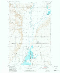
The Fort Peck Indian Reservation dominates the western portion of this mid-century survey, its boundary marked by the meandering path of Big Muddy Creek. This landscape of the Missouri Plateau transitions from the broken terrain of Sauerkraut Coulee to the level lands of the Medicine Lake Migratory Waterfowl Refuge in the east. The small settlement of Homestead sits along the Great Northern railroad line, serving as a vital transportation point for local agriculture just north of the Sheridan and Roosevelt County line.
Find a feature on this map
16 named features on this map. Tap any name to fly to it.
Don’t see what you’re looking for? This feature index may not catch every label — zoom into the map to look around manually.
Map Details
Editions of this 1948 Homestead Map
2 editions found
Other maps of this area

1914 · Homestead
USGS Topo · 1:62,500

1947 · Rocky Point
USGS Topo · 1:24,000

1947 · Homestead
USGS Topo · 1:24,000

1948 · Rocky Point
USGS Topo · 1:24,000

1948 · Medicine Lake
USGS Topo · 1:24,000

1948 · Reserve
USGS Topo · 1:24,000

1948 · Alkali Coulee
USGS Topo · 1:24,000

1949 · Reserve
USGS Topo · 1:24,000

1949 · Alkali Coulee
USGS Topo · 1:24,000
1949 · Medicine Lake
USGS Topo · 1:24,000