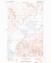
1947 Map of Rocky Point
USGS Topo · Published 1976About this map
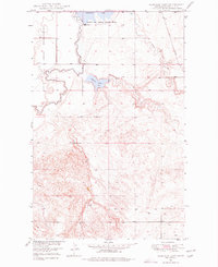
Rocky Point serves as a focal point in this 1940s landscape within the Fort Peck Indian Reservation in Roosevelt County. The Missouri River valley terrain is defined by the winding course of Muddy Creek and Smoke Creek, where the local transport network relied on crossings like Slab Crossing and the structure known as The Slab. The map captures a moment of transition for local industry and infrastructure, specifically noting the Goal Mines (Abandoned) in the northern hills. Rural social life is anchored by family-named landmarks such as Damm School No. 5 and the associated Damm Road, while the presence of Manning Lake and several springs highlights the importance of water resources in this Montana rangeland. The combination of early industrial remnants and established rural school districts provides a clear picture of mid-century life on the reservation.
Find a feature on this map
14 named features on this map. Tap any name to fly to it.
Don’t see what you’re looking for? This feature index may not catch every label — zoom into the map to look around manually.
Map Details
Editions of this 1947 Rocky Point Map
2 editions found

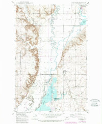
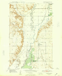
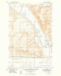
Other maps of this area

1909 · Smoke Creek
USGS Topo · 1:62,500

1912 · Smoke Creek
USGS Topo · 1:62,500

1914 · Brockton
USGS Topo · 1:62,500

1914 · Homestead
USGS Topo · 1:62,500
1947 · Homestead
USGS Topo · 1:24,000
1948 · Homestead
USGS Topo · 1:24,000

1948 · Rocky Point
USGS Topo · 1:24,000

1948 · Fort Kipp
USGS Topo · 1:24,000
1949 · Fort Kipp
USGS Topo · 1:24,000
1949 · Johnson Lake
USGS Topo · 1:24,000