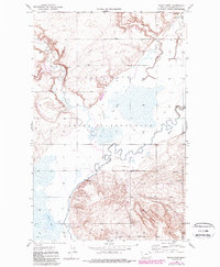
1947 Map of Rocky Point
USGS Topo · Published 1989About this map
Fort Peck Indian Reservation land dominates this northeastern Montana landscape, where the meandering course of Big Muddy Creek and its tributary, Muddy Creek, carve through the plains of Roosevelt County. The settlement of Rocky Point stands as a primary landmark above the river valley, while Slab Crossing provides a key point of transit across the water. The terrain is defined by its drainage network, including Smoke Creek and the notable Irish Coulee in the north, where Grain Bins signal the agricultural utility of the land. Transportation follows the contours of the coulees and creek beds, with named routes like The Slab Road and Damm Road connecting disparate sections of the reservation. Broad wetlands and seasonal water features such as Manning Lake highlight the hydrology of this prairie region as it appeared in the late 1940s.
Find a feature on this map
14 named features on this map. Tap any name to fly to it.
Don’t see what you’re looking for? This feature index may not catch every label — zoom into the map to look around manually.
Map Details
Editions of this 1947 Rocky Point Map
2 editions found
Other maps of this area

1909 · Smoke Creek
USGS Topo · 1:62,500

1912 · Smoke Creek
USGS Topo · 1:62,500

1914 · Brockton
USGS Topo · 1:62,500

1914 · Homestead
USGS Topo · 1:62,500

1947 · Rocky Point
USGS Topo · 1:24,000

1947 · Homestead
USGS Topo · 1:24,000

1948 · Homestead
USGS Topo · 1:24,000

1948 · Rocky Point
USGS Topo · 1:24,000

1948 · Fort Kipp
USGS Topo · 1:24,000

1949 · Fort Kipp
USGS Topo · 1:24,000