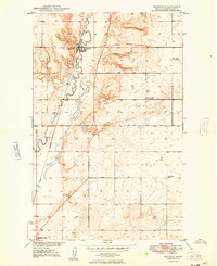
1949 Map of Reserve
USGS Topo · Published 1949About this map
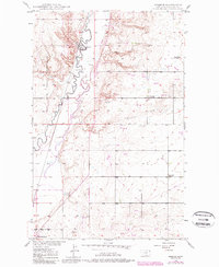
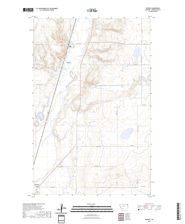
Reserve serves as the focal point for this 1940s survey of Sheridan County, situated along the Great Northern rail line and the meandering banks of Big Muddy Creek. This period in the Missouri River Basin development reveals a rural landscape transitioning its educational infrastructure, as evidenced by the presence of Eden Valley Sch alongside institutions already marked as inactive, such as Rose Hill Sch (Aban'd) and Smith Sch (Aban'd). The eastern portion of the Fort Peck Indian Reservation dominates the western half of the map, characterized by its sharp coulees and the valley of Otter Creek. Small-scale resource extraction and local transport are visible through the local Coal Mine, a Gravel Pit, and a dedicated Landing Field south of the town center. Rural life is further mapped through isolated landmarks like the Eden Valley settlement and the Cem situated on the high ground overlooking Reserve Creek.
Find a feature on this map
17 named features on this map. Tap any name to fly to it.
Don’t see what you’re looking for? This feature index may not catch every label — zoom into the map to look around manually.
Map Details
Editions of this 1949 Reserve Map
This is the sole edition of this map. No revisions or reprints were ever made.
Historical Maps of Medicine Lake Through Time
7 maps found