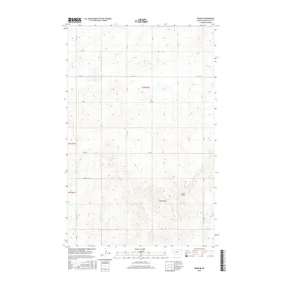
2017 Map of Froid SE
USGS Topo · Published 2017About this map
Devils Kitchen dominates the southeastern quadrant of this prairie landscape, where the terrain breaks into more complex drainage patterns compared to the surrounding High Plains. This 2017 survey captures the rural layout of Roosevelt County, where the economy remains tied to the vast section-line grid system established by the Public Land Survey System. The area is defined by its intermittent watercourses, including W Shotgun Cr and Lost Cr, which carve shallow paths across the high plateau. In the northwest, Duck Lake serves as a significant hydrological marker amidst a network of rural routes like E N Froid Rd and Hwy 405 N. The map provides a clear look at the enduring geometry of Montana's ranching country, showing the transition from flat tablelands to the more dissected coulees of the Missouri River watershed.
Find a feature on this map
23 named features on this map. Tap any name to fly to it.
Don’t see what you’re looking for? This feature index may not catch every label — zoom into the map to look around manually.
Map Details
Editions of this 2017 Froid SE Map
This is the sole edition of this map. No revisions or reprints were ever made.
Other maps of this area

1947 · Capeneys Lake
USGS Topo · 1:24,000

1948 · Capeneys Lake
USGS Topo · 1:24,000

1948 · Sunnyhill School
USGS Topo · 1:24,000

1948 · Medicine Lake
USGS Topo · 1:24,000

1949 · Sunnyhill School
USGS Topo · 1:24,000
1949 · Medicine Lake
USGS Topo · 1:24,000

1954 · Wolf Point
USGS Topo · 1:250,000

1958 · Wolf Point
USGS Topo · 1:250,000

1982 · Culbertson
USGS Topo · 1:100,000
1983 · Bainville
USGS Topo · 1:24,000