
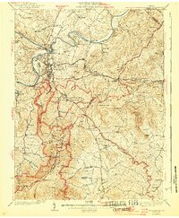
1944 Map of Front Royal
USGS Topo · Published 1944About this map
Front Royal serves as the focal point of this 1944 edition, positioned where the South Fork Shenandoah River and North Fork Shenandoah River converge. The landscape is dominated by the northern reaches of Shenandoah National Park, featuring the early route of Skyline Drive and the Appalachian Trail as they traverse the Blue Ridge Mountains. Industrial footprints are evident at Viscose City and Central City, while the presence of the U S Military Reservation and the Shenandoah Homesteads Project reflects federal involvement in the region's land use during the era.
Find a feature on this map
115 named features on this map. Tap any name to fly to it.
Don’t see what you’re looking for? This feature index may not catch every label — zoom into the map to look around manually.
Map Details
Editions of this 1944 Front Royal Map
2 editions found
Other maps of this area

1884 · Harpers Ferry
USGS Topo · 1:125,000

1891 · Harpers Ferry
USGS Topo · 1:125,000

1893 · Luray
USGS Topo · 1:125,000

1893 · Harpers Ferry
USGS Topo · 1:125,000

1894 · Warrenton
USGS Topo · 1:125,000

1894 · Warrenton
USGS Topo · 1:62,500

1894 · Winchester
USGS Topo · 1:125,000

1905 · Luray
USGS Topo · 1:125,000

1916 · Berryville
USGS Topo · 1:62,500

1923 · Middletown
USGS Topo · 1:62,500