1967 Map of Front Royal
USGS Topo · Published 1973About this map
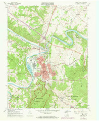
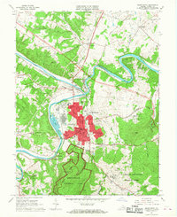
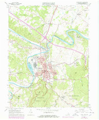
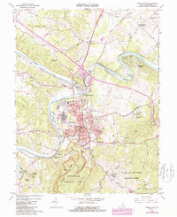
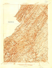
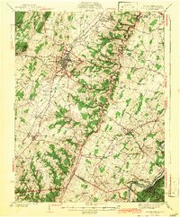
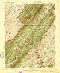
The convergence of the North Fork and South Fork to form the Shenandoah River dictates the landscape of this 1960s study. The industrial footprint of Viscose City sits prominently along the riverbank, balanced by the institutional grounds of the Randolph Macon Military Academy and the recreational gateway at the Skyline Caverns Entrance. Cultural landmarks including the Prospect Hill Cem and Crosby Stadium reflect the established community life in Front Royal, while the surrounding terrain is marked by the presence of Shenandoah National Park and the scenic Skyline Drive. Transportation patterns are well-defined by the Norfolk and Western and Southern railroads, alongside traces of the Manassas Gap RR (Abandoned). Further out, the landscape transitions into agricultural and resource-rich zones featuring numerous quarries and the expansive U S Dept of Agriculture Research Center.
Find a feature on this map
74 named features on this map. Tap any name to fly to it.
Don’t see what you’re looking for? This feature index may not catch every label — zoom into the map to look around manually.
Map Details
Editions of this 1967 Front Royal Map
4 editions found
Other maps of this area

1893 · Luray
USGS Topo · 1:125,000

1894 · Winchester
USGS Topo · 1:125,000

1905 · Luray
USGS Topo · 1:125,000

1923 · Middletown
USGS Topo · 1:62,500
1937 · Middletown
USGS Topo · 1:48,000

1938 · Winchester
USGS Topo · 1:48,000

1939 · Front Royal
USGS Topo · 1:48,000
1942 · Winchester
USGS Topo · 1:62,500
1943 · Middletown
USGS Topo · 1:62,500

1944 · Front Royal
USGS Topo · 1:62,500