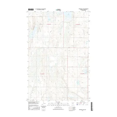
2016 Map of Frontenac Lake
USGS Topo · Published 2016About this map
Lake Plantagenet and the Schoolcraft River define this Northwoods landscape within the Mississippi River headwaters region of Hubbard County. The terrain is characterized by a dense network of glacial basins and watercourses, including the notable Frontenac Lake, Marsh Lake, and the winding Kabekona River in the south. The hydrography of the area is intricate, with smaller flows like Bungashing Creek and Frontenac Creek feeding into larger systems. Development remains concentrated along a grid of rural routes such as County Road 9 and County Road 118, which provide access to scattered lakeside properties and the surrounding timberland. This 2016 survey illustrates the modern layout of these water-dependent communities, tracing the transition from established roads like Skyline Drive to forest tracks such as Reserve Trail that navigate the marshy lowlands and densely clustered lakes.
Find a feature on this map
40 named features on this map. Tap any name to fly to it.
Don’t see what you’re looking for? This feature index may not catch every label — zoom into the map to look around manually.
Map Details
Editions of this 2016 Frontenac Lake Map
This is the sole edition of this map. No revisions or reprints were ever made.
Other maps of this area

1954 · Bemidji
USGS Topo · 1:250,000

1957 · Bemidji
USGS Topo · 1:250,000

1958 · Bemidji
USGS Topo · 1:250,000

1968 · Guthrie
USGS Topo · 1:24,000

1968 · Bemidji East
USGS Topo · 1:24,000

1968 · Frontenac Lake
USGS Topo · 1:24,000

1968 · Bemidji West
USGS Topo · 1:24,000

1972 · Laporte
USGS Topo · 1:24,000
1972 · Grant Lake
USGS Topo · 1:24,000

1972 · Lake George
USGS Topo · 1:24,000