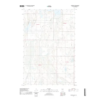
2019 Map of Frontenac Lake
USGS Topo · Published 2019About this map
The Schoolcraft River winds through a dense network of wetlands and glacial basins in this Hubbard County landscape, connecting the waters of Lake Plantagenet to the broader drainage of north-central Minnesota. The area is characterized by an intricate hydrographic pattern where major arteries like the Kabekona River and Alcohol Cr are fed by numerous secluded water bodies, including Frontenac Lake and the marshy expanses surrounding Marsh Lake.
Find a feature on this map
39 named features on this map. Tap any name to fly to it.
Don’t see what you’re looking for? This feature index may not catch every label — zoom into the map to look around manually.
Map Details
Editions of this 2019 Frontenac Lake Map
This is the sole edition of this map. No revisions or reprints were ever made.
Other maps of this area

1954 · Bemidji
USGS Topo · 1:250,000

1957 · Bemidji
USGS Topo · 1:250,000

1958 · Bemidji
USGS Topo · 1:250,000

1968 · Guthrie
USGS Topo · 1:24,000

1968 · Bemidji East
USGS Topo · 1:24,000

1968 · Frontenac Lake
USGS Topo · 1:24,000

1968 · Bemidji West
USGS Topo · 1:24,000

1972 · Laporte
USGS Topo · 1:24,000
1972 · Grant Lake
USGS Topo · 1:24,000

1972 · Lake George
USGS Topo · 1:24,000