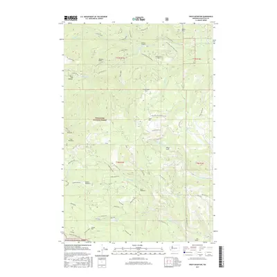
2017 Map of Frost Mountain
USGS Topo · Published 2017About this map
Frost Mountain stands as a central landmark in this high-country survey of the Wenatchee National Forest. The landscape is defined by the complex drainage systems of the N Fork Taneum and S Fork Manastash rivers, which carve deep valleys through Taneum Ridge and Cle Elum Ridge. High-altitude water bodies including Lost Lake and Manastash Lake anchor the southern elevations near Manastash Ridge-East. The distribution of named meadows and flats, such as Keenan Meadows and Gooseberry Flat, reveals the seasonal grazing and gathering patterns characteristic of the Cascades. An extensive network of forestry roads, including Nat For Dev Rd 3300 and the Gooseberry Flat Driveway, crisscrosses the terrain, providing access to remote points like Osborn Point and Gnat Flat during the mid-2010s.
Find a feature on this map
64 named features on this map. Tap any name to fly to it.
Don’t see what you’re looking for? This feature index may not catch every label — zoom into the map to look around manually.
Map Details
Editions of this 2017 Frost Mountain Map
This is the sole edition of this map. No revisions or reprints were ever made.
Other maps of this area

1897 · Mount Stuart
USGS Topo · 1:125,000

1899 · Ellensburg
USGS Topo · 1:125,000

1901 · Ellensburg
USGS Topo · 1:125,000

1901 · Snoqualmie Pass
USGS Topo · 1:125,000

1902 · Mount Aix
USGS Topo · 1:125,000

1902 · Mount Stuart
USGS Topo · 1:125,000

1903 · Snoqualmie
USGS Topo · 1:125,000

1904 · Mt Aix
USGS Topo · 1:125,000

1950 · Yakima
USGS Topo · 1:250,000

1957 · Wenatchee
USGS Topo · 1:250,000