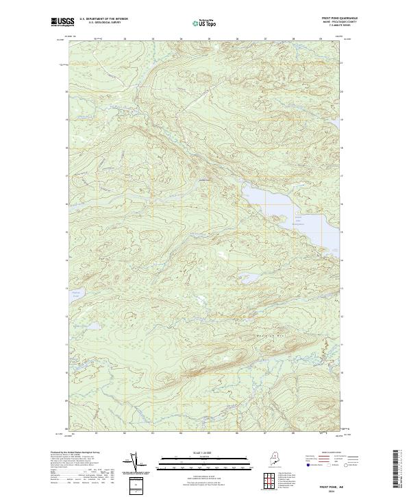
2024 Map of Frost Pond
USGS Topo · Published 2024About this map
Grand Lake Matagamon dominates the eastern edge of this wilderness landscape in Piscataquis County, where the East Branch Penobscot River winds through dense forest and lowlands. The terrain is defined by dramatic water features and isolated summits, including the notable waterfall at Grand Pitch and the rise of Wadleigh Mtn. Extensive wetlands like Wadleigh Bog and smaller water bodies such as Hudson Pond and Blunder Pond illustrate the complex drainage patterns of the North Maine Woods. A network of primitive timber and access roads, including Park Tote Rd and the evocatively named Moose Bone Rd, provides the only modern passage through these remote townships. This survey captures a modern look at a region where traditional logging routes intersect with preserved natural areas, showing the continued significance of names like Brayley Ridge and Webster Brook in local geography.
Find a feature on this map
27 named features on this map. Tap any name to fly to it.
Don’t see what you’re looking for? This feature index may not catch every label — zoom into the map to look around manually.
Map Details
Editions of this 2024 Frost Pond Map
This is the sole edition of this map. No revisions or reprints were ever made.
Other maps of this area

1953 · Telos Lake
USGS Topo · 1:62,500

1954 · Spider Lake
USGS Topo · 1:62,500

1954 · Millinocket Lake
USGS Topo · 1:62,500

1954 · Presque Isle
USGS Topo · 1:250,000

1955 · Traveler Mountain
USGS Topo · 1:62,500

1957 · Telos Lake
USGS Topo · 1:62,500

1958 · Presque Isle
USGS Topo · 1:250,000

1960 · Presque Isle
USGS Topo · 1:250,000

1961 · Spider Lake
USGS Topo · 1:62,500
1975 · The Traveler
USGS Topo · 1:24,000