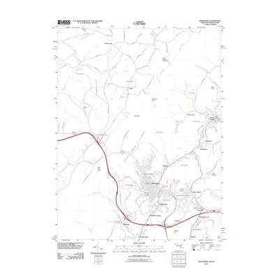
2011 Map of Frostburg
USGS Topo · Published 2011About this map
Frostburg and its surrounding coal-country communities are documented here as they appeared in 2011, showing the dense settlement of the Georges Creek Valley. The landscape is defined by its industrial legacy and educational footprint, anchored by the Frostburg State University campus and various historic mining sites. The map traces the winding paths of Jennings Run and Georges Creek, which historically supported the region's extraction industries. Many small settlements that grew around mines and rail lines are visible, including Eckhart Mines, Midlothian, and Grahamtown. Notable infrastructure like the Borden Tunnel and Horseshoe Curve reflect the challenging topography of the Allegheny Front. For genealogists and local historians, several burial grounds such as Allegany Cemetery and Rose Meadow Cemetery provide vital links to the families of this western Maryland highland, while sites like Borden Shaft point to the underground workings that once dominated the local economy.
Find a feature on this map
129 named features on this map. Tap any name to fly to it.
Don’t see what you’re looking for? This feature index may not catch every label — zoom into the map to look around manually.
Map Details
Editions of this 2011 Frostburg Map
This is the sole edition of this map. No revisions or reprints were ever made.
Other maps of this area

1898 · Frostburg
USGS Topo · 1:62,500

1899 · Grantsville
USGS Topo · 1:62,500

1901 · Frostburg
USGS Topo · 1:62,500

1904 · Grantsville
USGS Topo · 1:62,500

1908 · Frostburg
USGS Topo · 1:62,500

1921 · Meyersdale
USGS Topo · 1:62,500

1923 · Berlin
USGS Topo · 1:48,000

1929 · Berlin
USGS Topo · 1:62,500

1939 · Meyersdale
USGS Topo · 1:62,500

1944 · Berlin
USGS Topo · 1:62,500