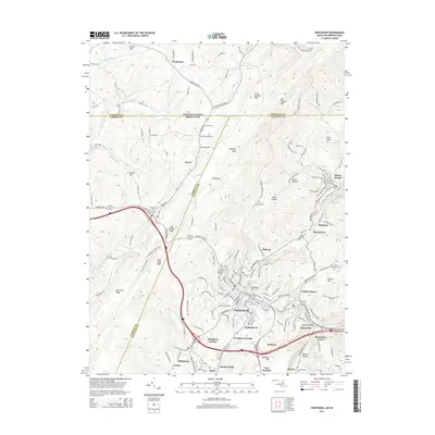
2014 Map of Frostburg
USGS Topo · Published 2014About this map
Frostburg serves as the hub of this Allegany County landscape, characterized by the tight integration of academic, industrial, and transportation history. The presence of Frostburg State University stands alongside a legacy of extraction, visible in settlements like Eckhart Mines, Borden Shaft, and Midlothian that follow the coal-bearing valleys. The terrain is dominated by the massive ridge of Big Savage Mountain, which funnels travel through corridors like Wolf Gap and past the distinctive Horseshoe Curve.
Find a feature on this map
170 named features on this map. Tap any name to fly to it.
Don’t see what you’re looking for? This feature index may not catch every label — zoom into the map to look around manually.
Map Details
Editions of this 2014 Frostburg Map
This is the sole edition of this map. No revisions or reprints were ever made.
Other maps of this area

1898 · Frostburg
USGS Topo · 1:62,500

1899 · Grantsville
USGS Topo · 1:62,500

1901 · Frostburg
USGS Topo · 1:62,500

1904 · Grantsville
USGS Topo · 1:62,500

1908 · Frostburg
USGS Topo · 1:62,500

1921 · Meyersdale
USGS Topo · 1:62,500

1923 · Berlin
USGS Topo · 1:48,000

1929 · Berlin
USGS Topo · 1:62,500

1939 · Meyersdale
USGS Topo · 1:62,500

1944 · Berlin
USGS Topo · 1:62,500