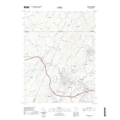
2019 Map of Frostburg
USGS Topo · Published 2019About this map
Frostburg sits at the heart of this Allegany County landscape, where the legacy of Appalachian industry is etched into the terrain. The map traces the corridor of the Western Maryland Railway and the Potomac Heritage National Scenic Trail as they navigate the ridges of Big Savage Mtn and Little Savage Mtn. This area is defined by its deep mining history, evidenced by settlements like Eckhart Mines, Borden Shaft, and Shaft, which speak to the historic coal operations that once dominated the regional economy.
Find a feature on this map
168 named features on this map. Tap any name to fly to it.
Don’t see what you’re looking for? This feature index may not catch every label — zoom into the map to look around manually.
Map Details
Editions of this 2019 Frostburg Map
This is the sole edition of this map. No revisions or reprints were ever made.
Other maps of this area

1898 · Frostburg
USGS Topo · 1:62,500

1899 · Grantsville
USGS Topo · 1:62,500

1901 · Frostburg
USGS Topo · 1:62,500

1904 · Grantsville
USGS Topo · 1:62,500

1908 · Frostburg
USGS Topo · 1:62,500

1921 · Meyersdale
USGS Topo · 1:62,500

1923 · Berlin
USGS Topo · 1:48,000

1929 · Berlin
USGS Topo · 1:62,500

1939 · Meyersdale
USGS Topo · 1:62,500

1944 · Berlin
USGS Topo · 1:62,500