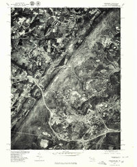
1977 Map of Frostburg
USGS Topo · Published 1979About this map
Frostburg serves as the central hub on this 1970s orthophotoquad, where the dense grid of the college town meets the industrial and agricultural landscapes of Allegany County. This aerial imagery, captured by the U.S. Geological Survey in cooperation with the Soil Conservation Service, reveals the high-contrast patterns of surface activity and the winding corridors of the Appalachian terrain. To the east, the settlement at Eckhart Mines and the community of Mount Savage follow the natural contours carved by Jennings Run, reflecting a settlement pattern deeply tied to the region's mining and transportation history.
Find a feature on this map
8 named features on this map. Tap any name to fly to it.
Don’t see what you’re looking for? This feature index may not catch every label — zoom into the map to look around manually.
Map Details
Editions of this 1977 Frostburg Map
This is the sole edition of this map. No revisions or reprints were ever made.
Other maps of this area

1898 · Frostburg
USGS Topo · 1:62,500

1899 · Grantsville
USGS Topo · 1:62,500

1901 · Frostburg
USGS Topo · 1:62,500

1904 · Grantsville
USGS Topo · 1:62,500

1908 · Frostburg
USGS Topo · 1:62,500

1921 · Meyersdale
USGS Topo · 1:62,500

1923 · Berlin
USGS Topo · 1:48,000

1929 · Berlin
USGS Topo · 1:62,500

1939 · Meyersdale
USGS Topo · 1:62,500

1944 · Berlin
USGS Topo · 1:62,500