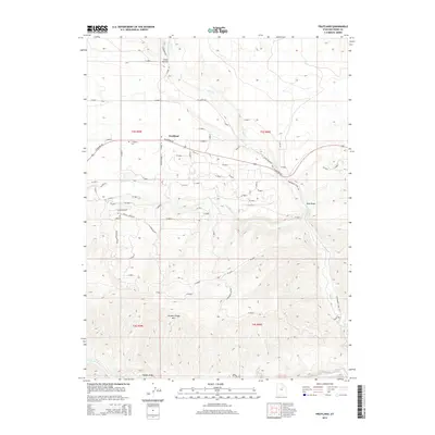
2014 Map of Fruitland
USGS Topo · Published 2014About this map
Fruitland and its surrounding high-altitude drainage basins are documented in this 2014 survey of the western Uintah Basin. The settlement is centered along W Highway 40, which serves as the primary east-west artery across the Duchesne County landscape. The mapping reveals a detailed network of rural residential roads including S Bandanna Dr, Saddle Brook Ln, and W Young Meadows Dr, indicating the area's development into large-lot holdings and recreation-adjacent properties.
Find a feature on this map
69 named features on this map. Tap any name to fly to it.
Don’t see what you’re looking for? This feature index may not catch every label — zoom into the map to look around manually.
Map Details
Editions of this 2014 Fruitland Map
This is the sole edition of this map. No revisions or reprints were ever made.
Other maps of this area

1885 · Uinta
USGS Topo · 1:250,000

1954 · Salt Lake City
USGS Topo · 1:250,000

1958 · Salt Lake City
USGS Topo · 1:250,000

1960 · Salt Lake City
USGS Topo · 1:250,000

1962 · Deep Creek Canyon
USGS Topo · 1:24,000

1962 · Strawberry Pinnacles
USGS Topo · 1:24,000
1962 · Sams Canyon
USGS Topo · 1:24,000

1962 · Fruitland
USGS Topo · 1:24,000

1962 · Tabiona
USGS Topo · 1:24,000

1962 · Raspberry Knoll
USGS Topo · 1:24,000