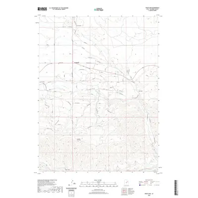
2020 Map of Fruitland
USGS Topo · Published 2020About this map
Fruitland occupies a high-elevation plateau where the Strawberry River and Currant River converge, serving as a vital crossroads in Duchesne County. The settlement pattern here is dictated by the rugged basin-and-range topography, with ranching infrastructure and local roads like Lower Ranch Rd and Saddle Brook Ln following the natural contours of Cedar Ridge and Grass Hollow. For those researching local families, the Fruitland Cem is a primary landmark situated near the junction of several ranching routes. The landscape is defined by dramatic elevation changes, rising from the riparian corridors of Red Cr to the summit of Currant Creek Mtn. The intricate drainage network, including the seasonal Sand Wash and the secluded Hayes Ponds, reflects a region where water management and access remain central to the community's geographic identity.
Find a feature on this map
87 named features on this map. Tap any name to fly to it.
Don’t see what you’re looking for? This feature index may not catch every label — zoom into the map to look around manually.
Map Details
Editions of this 2020 Fruitland Map
This is the sole edition of this map. No revisions or reprints were ever made.
Other maps of this area

1885 · Uinta
USGS Topo · 1:250,000

1954 · Salt Lake City
USGS Topo · 1:250,000

1958 · Salt Lake City
USGS Topo · 1:250,000

1960 · Salt Lake City
USGS Topo · 1:250,000

1962 · Deep Creek Canyon
USGS Topo · 1:24,000

1962 · Strawberry Pinnacles
USGS Topo · 1:24,000
1962 · Sams Canyon
USGS Topo · 1:24,000

1962 · Fruitland
USGS Topo · 1:24,000

1962 · Tabiona
USGS Topo · 1:24,000

1962 · Raspberry Knoll
USGS Topo · 1:24,000